Tuesday, October 25, 2005

A Small Worm in the Big Apple

Hi there!

If you're curious about our move and adjustment to New York City, check out my new blog new blog. It's been nothing but adventurous so far!

Sunday, October 09, 2005

July 27th – 31st – Chicago, IL and Sawyer, MI

We drove from Grinnell up to Chicago, or rather, Riverside, IL. This is a lovely community outside of Chicago proper, but has commuter trains. We were here to visit Hope and Michael, and meet their three children, Felix and his twin sisters Lethea and Cordania. Toby and Hope met about 10 years ago, while fishing somewhere in Northern Norway. Things have changed since then, but luckily people retain their fun-loving and interesting natures! (=

We spent the first few days hanging out in Riverside, playing with the kids and walking around the cute town and enjoying DELICIOUS food! Hope is a conniseur of yummy food. As she put it, "My New Year's resolution is always to eat better. For most people, that means to eat healthier. For me, it means to eat more deliciously!" No wonder she and I got along!

Toby and I did get into Chicago downtown one afternoon, and explored some of the beautiful buildings and saw the Gehry-designed Millennium Park, and watched yatchs at the marina.

Then we all went to the weekend house in Michigan. It was quiet and right near the lake. We went for a bit of a hike one evening to watch the sunset from atop the lake dunes. Wow! Unfortunately, Toby was bitten by some bug, and we think it might be a black widow. Luckily, he had fairly mild symptoms.

July 26th – 27th – Grinnell, Iowa

It was blissfully cool and rainy! Woo-hoo! I think the high on the 26th was down around 67 F – room temperature. The rain was a welcome relief too, after days in the desert and then into the rain-starved prairies. We stopped for lunch at a cute diner in a small town, where Toby and I stood out like sore thumbs. The food was good and filling though, and people were friendly.

Then we arrived into Grinnell, the town of Toby’s alma mater, and went straight towards the college. It’s a beautiful campus, full of old buildings and green spaces and many trees. Toby showed me the science buildings and residences where he’d lived. Much had changed in the last 8 years since he graduated; buildings had been added, knocked down, or renovated. Still, it was great to get a feeling for the place!

In town, we found a café with coffee, tea and snacks, and rested for a while. Got a motel for the night, and went out for a memorable steak meal! Rube’s even has internet ordering capabilities now! There is no menu; instead, visitors get a tour of the meat fridge, choose a cut, and grill it on the gigantic brickette-fired BBQ! Potatoes, Texas toast, and a salad bar are included. What a fun place! I had a small (8oz) filet mignon, while Toby had a 20oz rib eye.


The following morning, we headed back to campus, where Toby was able to meet up with one of his mentors, Luther. We sat in Luther’s office/lab and had a lovely chat. Having to get to Chicago that afternoon, we had to leave Grinnell before lunch, and drove eastward into Illinois.

July 24th – 26th – Kirksville, MO

Kirksville is a small town in northern Missouri, a state where all the secondary highways are named with letters! Like Kansas, Missouri’s highway system is fairly grid-like, making navigation easy. We continued to follow the heat-wave. Although the air temperature was dropping (it was only about 100 F), the humidity was rising!


Here, we were visiting Maria (Toby’s college friend), Eric and their nearly-two-year-old Andrew. As with Toby’s other friends, Maria and Eric were wonderful hosts! And Andrew was sweet, constantly babbling to himself. Toby and I could only understand a few of his words, most of which involved trucks; “dump truck” and “fire truck” were his favourites! Eric and Maria are both chemistry profs at Truman State University, and Toby had a tour of their labs and the university the next day, while I slept in and relaxed in their lovely, quiet home. Did I mention they have 4 cats? All were friendly and affectionate. There were also several fish tanks in the home, so I was entertained the entire day.


We had yet another BBQ. I love summers for the BBQ-ed food! Yum! And had another wonderful evening of chatting and laughing!

The next morning, Toby and I headed northward into Iowa.

July 22nd – 24th– Lawrence, KS


We drove from Limon, CO into Kansas, remarking how flat and prairie-like western Colorado is! The weather was still hot, plus the added “bonus” of humidity. Yuck! We arrived into the city of Lawrence, situated nearly halfway between Toledo and Kansas City. Here, we were visiting Heather and Chad, Toby’s college friends. They have a cute place with two dogs: Piper, a rat terrier – Chihuahua cross, and Houdini, a rat terrier puppy. They were energetic, especially when playing together, but adorable!


Heather took us on a tour of her lab (she’s a chemist at Kansas State University) and into the lovely downtown area. Since it was quite hot out, we went into many stores, mostly just to bask in their air-conditioning! Chad arrived home from his weekend class in time to BBQ dinner. Yum! It was wonderful to spend the evening just relaxing and chatting!

The following morning, we headed out for a humungous brunch, and then had to say good-bye. Toby and I were driving further east, across the Missouri River.

Thursday, August 04, 2005

We're Still Alive

Hey Everyone! Just wanted to post a short message to say we're still alive. We're actually in Toronto now, and should be able to get our blog up-to-date in the next few days. For the record, we're still in a heat-advisory region. Will it ever be cool again? Stay tuned...

Friday, July 22, 2005

July 21 - Montrose to Limon, CO

It was such a nice morning! Toby woke up early and enjoyed the quiet, cool, sunny patio and kitchen. Slowly the rest of the household awoke, and we ended up chatting at the kitchen table the rest of the morning away. We then headed to Main St. for lunch/brunch with Susan and Max, and Toby and I headed on the road again.


The drive through the Rockies was beautiful: snow-touched peaks, deep gorges, pretty streams. We’ll certainly miss this landscape as we head towards the prairie Midwest. The air was noticeably more humid after crossing the Continental Divide. Ick. I’d forgotten how much I don’t like humidity!

We stopped for lunch in Colorado Springs, at a fast-food noodle and pasta place. Yum! And drove a little further east. Saw the rising of a gorgeous (Hunter’s?) moon – huge and deep orange on the horizon. Arrived at Limon, a crossroads between Interstate 40 and highway 24. Thought it would be easy to get a motel, but it turns out there’s a kids’ softball tournament right now! We finally managed to find a non-smoking, affordable room after trying 4 other motels on the highway strip. Thankfully, as we were tired.

Eolus - Montrose, CO


Eolus, the cat who calls Max and Susan his humans, is named for one of the 54 peaks in Colorado which is over 14000 ft tall.

July 20 - Cortez to Montrose, CO

After a week of rushing from park to park it was so nice to be actually visiting people today! We drove north, into the Rockies, to visit Max and Susan (friends from Grinnell). Both are teachers in the Montrose area, so it’s lucky that we are visiting in the summertime or we might never have seen them. We had a lovely afternoon and evening chatting and wonderful meal.

While sitting at the kitchen table at night, chatting away, we heard a noise by the windows. Opening up a blind, we came face to face with a tabby kitten hanging onto the screen mesh! We think she was chasing bugs which had been attracted to the indoor lights. All the humans were entertained for quite a while, watching the kitten chasing bugs in the grass. Eolus, Susan and Max’s cat, was less impressed, however. He's a two-human, one-pet cat! Luckily he's also very cute and affectionate with his family.

Thursday, July 21, 2005

Kivas - Mesa Verde NP


This photo shows early puebloan dwellings (500-700 AD) consisted of partially subterreanean pits about 15-ft in diameter with a smaller circular storage antechamber. As the population grew and the civilization progressed, the outer chambers evolved into kivas, places of worship. Kivas included a hearth in the center of the room and a small, circular and shallow hole called a 'sipapu', symbolic of the people's emergence into this world. Later kivas had ventilation shafts and deflection shields to ward off cold drafts. By the time of the cliff dwellings, kivas were completely "underground", having a fairly solid abode roof acting as the floor for the next storey. Near the end of the ancient puebloans in this region, incredible multi-storey towers were built in the cliff dwellings.

Kris on stairs from Cliff Palace - Mesa Verde NP


Warning signs were posted everywhere about the strenuous hiking and climbing required to access the cliff dwellings. Not too surprising, since these were built into the sides of cliffs. And they weren't kidding! With the high altitude and heat, it wasn't an easy climb into or out of the tour site. Here's a photo of Kris going down rather tall, narrow steps to enter Cliff Palace. The staircase was in between several wooden ladders. The stairs were actually built in the 1930's as make-work projects; the native puebloans used hand-toe holds to reach these places. This tour was the easiest to access; the one tour we didn't do included a 30-ft ladder climb and a crawl through a 2-ft-wide tunnel. The visitors center even had a full-sized model of the tunnel (I think it was so you could decide if you could fit through it).

Cliff Palace - Mesa Verde NP


Here's a view of Cliff Palace, one of the latter dwelling ruins (approx. 1200 AD) in the park. It was really neat to see the masonary work up-close and to hear stories of the ancient puebloans who had lived here. Speculation is that this was more of a religious place, with its high density of 'kivas' - deeply carved round chambers of worship.

July 19 - Mesa Verde National Park

Mesa Verde literally translates as "green table", where the green comes from vegetation on these flat-topped geological structures. Yesterday, we saw "blue mesa" (blue from carbon deposits in the rock) and "red mesa" (red from iron oxide) at Petrified Forest. So now we have a complete set of primary mesas!

Again, we tried to get going fairly early to avoid some of the afternoon heat, and drove up to Mesa Verde in beautiful morning light. As a bonus, the morning temperature at these higher elevations was only about 60F (15C) – a welcome relief! The mesa was absolutely stunning, with its geology written in huge bands of colored sandstone for all to see. We climbed winding roads up and up and up through scrubby oak trees, and a forest of dead pine and juniper trees (much of the park was burned by wildfires in 2000). We purchased tickets at the visitor center for tours of two of the archeological sites for which Mesa Verde Park was created – both sites are villages set into alcoves of the cliffs overlooking dramatic canyons.

Our first tour was of “cliff palace,” the largest of the alcove sites with over 100 rooms and over 20 Kivas (ceremonial underground chambers). To access the site we descended some impressively steep stairs cut into the rock by the CCC in the 1930s and climbed a few stout ladders. It was amazing to think that the original inhabitants climbed in and out using hand carved hand and toe holds that didn’t look more than an inch deep and ran practically straight up the canyon wall! The city was amazing, with multistory buildings and separate seed storage areas. Because of the dry southwest air there were even some well preserved timbers (used to make lintels, and to support the roofs) left after nearly 800 years of abandonment.

In the afternoon we explored some of the sites on the Wetherhill Mesa (a slightly less visited area of the park) along self-interpretive trails. Then began a second guided tour, this time to “long house.” Again this was a huge collection of beautifully constructed buildings tucked away under an overhang in the canyon wall. Since the group on this tour was much smaller (about 15, as opposed to the earlier tour of 50) it was possible to get much closer to everything and look at the details. The tour group moved in a much more leisurely fashion as well, which meant that had a chance to imagine the site as it once was as well as enjoy it as it now is.

We spent the rest of the afternoon driving to a few other accessible sites, mostly for earlier dwellings (500-700 AD) on top of the mesas (the cliff dwellings were only occupied for a brief span of time, just before the population left Mesa Verde for good). Then we hurried back to Cortez for some tasty Chinese take-out.

Petrified Wood, Petrified Forest NP


While it may look like normal wood in a photo (at even in person), this is as heavy as any other giant block of agate. It is sometimes hard to believe the (petrified) wood is actually stone until you touch it.

Petrifed wood everywhere! (Petrified Forest NP)


These may look like random rocks, but almost all the rocks you can see in this photo are chunks of petrified wood. They are everywhere!

Petroglyphs, Petrified Forest NP


This petroglyph includes a hapless frog, captured (and soon to be swallowed by) a Curlew.

Painted Desert, Petrified Forest NP


The Painted Desert lived up to its name. If it hadn't been so hot, we would've gone exploring! One can even get back-country permits to camp in the desert.

Pillars in the Desert


Another fun geological phenomenon from our journey. These pillars came as a bit of a surprise as we drove through NW New Mexico towards Colorado.

July 18th – Holbrook, AZ to Cortez, CO and Petrified Forest National Park

Departed early this morning in an attempt to catch some cooler air (less than 100F). We slept in Holbrook because it is only 30min from the Petrified Forest, so we arrived with few visitors yet and the temperature still manageable. We walked a few of the shorter interpretive trails, and marveled at the variety and abundance of petrified wood. There are mainly two types: permineralization leaves the tree cells intact and so this rock looks just like a log, while the second type allows agates to form into striking patches of colour. Both types are spectacular to see. Unfortunately, many years of looting had depleted the park of some reportedly amazing specimens, and the park now discourages this act with many warnings and even “emergency phones” located everywhere for reporting thefts or vandalism!

The landscape was like a mini badlands, with mesas and sediment layers exposed by erosion. There had been pueblos in the area, and archaeological work is in progress. This park also boasts a dense display of petroglyphs, which we enjoyed immensely. They’re beautifully done and the ‘desert varnish’ on the rock face is a brilliant contrast to the lighter rock underneath which gets exposed upon carving.

The north end of the park allows views and backcountry hiking into the Painted Desert. True to its name, the colours looked unreal, as if this were only a diarama we were seeing! It would have been really neat to have explored this area a bit more, but the heat (up near 105F) was getting to us.

After leaving the park, we drove further east into New Mexico, then turned north at Gallup. (Gallup reminded me of Red Deer, Alberta: from the highway it looks like a strip of fast food chains and nothing more.) From here, we drove through the Navajo Reservatioin and into Colorado. The mesas were spectacular. Also surreal were giant, jagged rock formations jutting out from the flatness of the surrounding area! Finally we pulled into Cortez, CO – just a few miles from Mesa Verde National Park.

Meteor Crater, Arizona


There's not much you can say about this place, except that you should see it for yourself. It's amazing, but it is very hard to photgraph except from aircraft -- the scale is simply too large.

Motel in Holbrook, CA


The remnants of Route 66 culture are truly fascinating - maybe next time we come through this area we will take the opportunity to stay at one of these wacky places and "sleep wigwam" as they advertise.

July 17th – Needles, CA to Holbrook, AZ and Meteor Crater

This was a relatively slow day. We had to recover a bit after that heat from yesterday! We left Needles, crossed the Colorado River into Arizona and basically drove along the interstate due east until just past Flagstaff. Here is the Barringer Meteor Crater, about 1km wide and approximately 100m deep (compared with surrounding plains). It’s a privately owned and operated site (amazingly enough) so it was a little pricey. We also arrived too late for the rim hike (which is the only way to see the crater besides the observation deck by the interpretive center). The interpretive center had a lot of information about meteors and asteroids and past collisions with Earth. But the crater itself stole the show! Different layers of rock was exposed on impact and some of the softer stone has been eroding. Barringer, for whom the crater was named, spent over 25 years trying to mine the crater in the early 1900’s; he was convinced there would be an iron deposit left from the meteorite. Unfortunately, he was wrong about that, but he did do a lot to convince the scientific community that this crater had been a meteorite impact and not volcanic in origin.

Baker, CA


Welcome to Baker, where the visitors' center is topped with a giant digital thermometer capable of displaying temperatures to 130F. When we first stopped by it was displaying about 112F (45C).

Joshua Tree, Mohave National Preserve


An overheated Kris underneath a Joshua tree, pining for even the smallest bit of shade.

Cinder Cone, Mojave NP


There were a bunch of fantastic cinder cones in the desert, set among the Joshua trees. And after all, weren't we all born to love volcanos?

Road to Kelso Dunes


While we really wanted to get close to the dunes in the preserve, the road was just too much for our little car. Even driving the car a speeds near 5mph could not reduce the jarring to a managable level. Next time maybe we should bring a jeep. You can see the dunes in the distance - this is as close as we got.

July 16th – Mojave National Preserve

After a large buffet breakfast at our hotel, we left Bakersfield, CA in the already-too-hot morning and drove eastward. Made stops in Barstow (for gas and drinks) and Baker, where the Visitor Center for the Mojave National Preserve is located. The center was blissfully cool, and had a large selection of field guides, photos and displays available in its fairly small space. The photo from space of the region was really neat: we could see Las Vegas, the Colorado River, and the large expanse of desert where we were. We discovered that the spring had been unusually wet, which caused the desert to bloom spectacularly and affect the wildlife as well. Unfortunately we missed the height of these displays.

The visitor center also informed us that the air outside was 113F (it was noon) and would be rising for a few hours yet. But being intrepid adventurers, we soldiered on in spite of the heat. (Keep in mind we had been using the car’s air conditioning for only about 10min a day and only for a few days so far, since the A/C causes the car to perform rather poorly.)

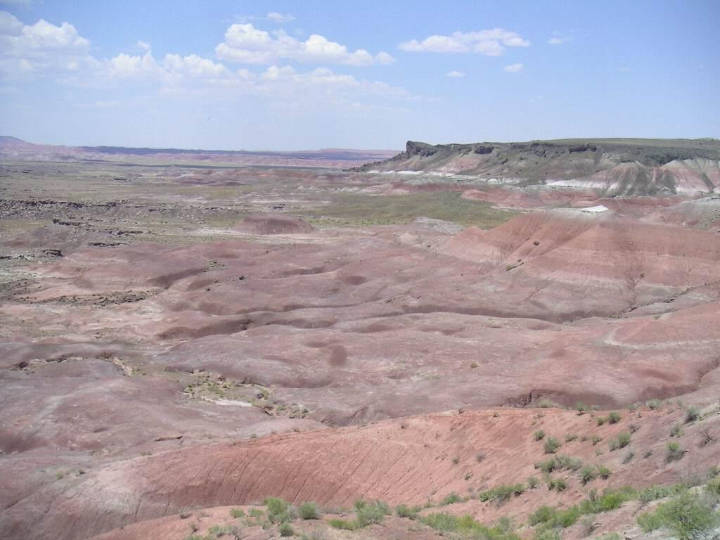
Tucked in between Interstates 15 and 40 is the Mojave National Preserve, where 3 of North America’s 4 desert systems collide. It’s a beautiful place with many different landscapes to explore. Only in the 1990’s did it get set aside as a natural area to preserve, so it’s rather unvisited and there are very few services within the park.

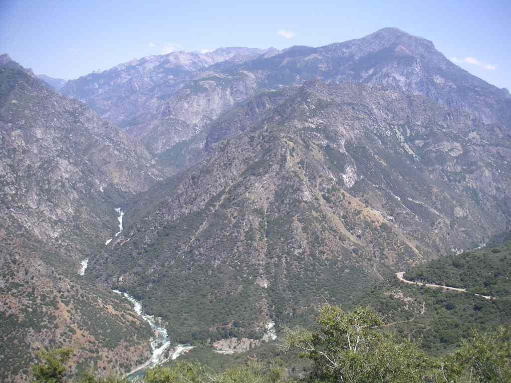
We took the Cima Road exit and headed south through the center of the Preserve. This gave us spectacular views of a set of mountains all around us, and our first close-up view of Joshua trees. These plants are actually one of three types of yuccas we saw in the park. Nevertheless they were beautiful in their odd, branched shapes and poofs of spiky leaves. We decided that, in spite of the heat, we had to explore outside of the car at least once, so we opted to take one of the few short trails – Teutonia Peak. This led us around a variety of yucca plants, many cacti and large rocks jutting out at odd angles. (Maybe these rocks were thrown here from volcanic activity in the region.) Even though it was 120F (that’s 50C!!), we managed to spot some wildlife too! There was an American kestral, scrub jays, and a lot of small birds we couldn’t identify. We also spotted a number of cute desert cottontails (which really looked like cartoon-cute bunnies) and several white-tailed antelope squirrels. These ground squirrels run with their tails flipped up along their back, exposing the brilliant white underside of the tails. Having to adapt to desert life, the antelope squirrel eats just about anything, and the ranger in Baker had informed us of seeing them with lizards in their mouths! And we did see ground squirrels eating the remnants of jackrabbits left by car collisions. Yuck!

Because of the intense heat, we had to turn back before reaching the end of the trail. The feel of the air blowing past was sometimes verging on painful, and anything that was exposed to the sun instantly heated up to an uncomfortable temperature. Up to this point of the trip I have had to carry the digital camera in my pocket to keep it warm enough to function well – today I had to keep it in my pocket so that it didn’t get much hotter than the ambient air temperature! Every time the strap on my shoulder bag shifted it would push another section of my shirt against my skin and feel like I was being scalded. After a couple hours exploring under these conditions we were both overheated, sluggish, and had completely lost our appetites. Thankfully we had wide brimmed hats, lots of sunscreen and two bottles of water or we may have regretted our walk. The car, upon our return, was too hot to touch despite the shade of a nearby mesquite bush but it was a welcome sight none the less.

After a cooling off period (with ice water in our cooler – that saved us today!), we drove further south, finally reaching the Kelso Depot. This elaborate building had once served as the train station for the Union Pacific Railway, but had been abandoned for years. The Preserve has been renovating it to use as its headquarters and visitors center, and should open soon.

Here, we turned north along Kelbaker Road, on which we drove about 15 miles to the lava beds. These rocks and large cinder cones were the shiny black we had expected to see at the Crater Lake Pumice Desert.

We turned around and headed south again, and had a wonderful view of the Kelso Dunes. These sandy-looking dunes certainly looked like the desert of Hollywood movies! They apparently made cool noises, from low rumblings to higher-pitched sounds. We tried to take the washboard road out to the dunes trailhead, but after about 1 mile, the car was not in good shape and we were overheating. So we had to turn around.

The other-worldly landscape did not end there, however. Near the south end of that road, we went through Granite Pass and Quail Flats, where we saw and heard quail. (It was late afternoon by that point, so more wildlife was starting to emerge.) The granite peaks were jagged and unlike mountains elsewhere!

Once we left the park, it was interstate driving through more desert. Sunset saw pastel pinks and purples and the desert peaks silhouetted. We drove into darkness and stopped for the night in Needles, CA, along the Colorado River and at the Arizona border. We’ll have to return to the Mojave some day, preferably in spring during a wet year to see the desert in bloom and to spend more time (when we won’t be in danger of heat stroke).

Moro Rock - Sequoia NP


Kris and Toby on top of Moro Rock -- the view was fantastic, even with all the haze blowing in from the rest of California.

Tunnel Log - Sequoia NP


When one needs to understand how big a sequoia is, what better way is there to show scale than to drive your car through a carved sequoia log. I mean, come on, it's obvious.

Crescent Meadow - Sequoia NP


This is a view across Crescent Meadow, a very pleasent walk in Sequoia National Park. There were tons of wildflowers to look at, and later on there was a bear to watch.

Agave Flowers in Sequoia NP


On the way outof the park we finally found a bunch of agave plants (banana yucca?) that were flowering and weren't on the edge of some precipitous drop-off. The flower stalks were awfully tall.

Friday, July 15, 2005

July 15th – Sequoia National Park to Bakersfield, CA

Got up early this morning after yet another uncomfortable night to find the air quite chilly. I guess it does get cool up at this altitude even this far south! We went south to Sequoia National Park and found the first helpful ranger so far this trip! Other rangers before and since have seemed actively to avoid (a) noticing someone has come within their vicinity and may want to ask something and (b) giving more than the bare bones answer to any questions asked. Very refreshing, then, to walk into the Giant Trees Museum and be greeted by a ranger who then offered all sorts of useful trail information! On her advice, we opted to avoid a more popular trail, and instead went for the Crescent and Log Meadows trail.

On the drive (down a spur road from the main highway through the park) we stopped at the marked highlights. There was the Auto Log, which had been used as something of a driveway for years until it started to decay beyond safe limits. People can still walk on it though, and that we did! We also made a stop at Tunnel Log, which as a tunnel burnt into it, and one can drive a car through it (we did). Moro Rock turned out to be much larger than I had anticipated, and involved walking up about 300ft (mostly on carved stone steps) to get a beautiful, nearly 360-degree vista at the top! Definitely worth the walk up, despite the scary warning signs about death-by-lightning. We also spotted cute Western Fence Lizards, one of which had evidently lost its tail in the past and had regrown another. The meadow walk was really nice too, with more giant sequoias to see and lots of wildflowers and birds and squirrels and chipmunks to see. About 500meters from the busy picnic area/trailhead was a cinnamon bear ripping bark off decaying logs (looking for lunch). Everybody seemed to think this was great, with not a glimmer of concern. While I was very glad to have a chance to see the bear during the walk, I’m used to people showing a little more concern. Especially when we heard that two sows with cubs were resident along the trail. Unfortunately, along with all the wonderful sights, there were also an abundance of mosquitoes and we had forgotten the DEET. Oops!

We drove down the winding road out of the park – at times the posted speed limit was 10MPH because of the sharp turns. Saw more large trees of all kinds, and more yucca plants. We’d seen these arid-climate plants all through this area and were amazed at their flower/fruit stalks. These stalks can stand nearly 10 ft tall, and the plants seem to produce only one before dying off. We’ll need to learn more about yuccas.

It’s another scorching day down at sensible elevations; we just checked the weather channel and found it had been 105F and 30% humidity today. No wonder the drive to Bakersfield was groggy and unpleasant! We even had to stop for road construction – I would have thought that construction season would be anything but summer, given the soaring temperatures here! A lot of smog seems to collect in this valley too (which includes Sacramento and Fresno). We’d originally planned to drive a few hours further, but just wanted to get out of the heat. So here we are at an air-conditioned motel, well fed from the diner/burger place next door, and updating our blog!

Tomorrow will be another scorcher, and we’re going through the Mojave Desert. Note to self and everyone reading this: next time, do this part of the continent during early spring or late fall!

July 14th Pictures -- Kings Canyon National Park


These two sequoias have grown together as they matured, and are known as the "Twin Sisters." They are located in Grant's Grove (Kings Canyon National Park) along with all sorts of other neat stuff. If you squint you might be able to make out Kris acting as scale at the base of the trees.


This view of Kings Canyon was taken as we descended into the canyon - the jagged rocky walls were peppered with shrubs tough enough to hold on, and lots of agave plants.


A beautiful walk near the end of the road meanders through rock fields and meadows under the face of North Dome - a really big cliff.

July 14th – Kings Canyon

Today we drove along the Generals Highway into both parts of Kings Canyon National Park. We made a stop at Grants Grove Village (just inside the eastern gate) to pick up supplies and do the short, paved loop displaying a stand of ‘famous’ trees – these trees were named for Civil War Leaders and states during the latter half of the 19th Century. These sequoias were certainly impressive in size! One fallen log, named the Monarch, had been used for a temporary shelter by Native Americans and early pioneers, and as a saloon and inn and to stable US Cavalry horses 100 years ago!

It was another hot day, and a picnic by Grizzly Falls was a welcomed respite. Unfortunately, the natural beauty was marred by a giant American flag planted over top of the falls – we weren’t aware that these falls were part of a territorial dispute.

We did a short meadow walk in the western part of the park, spotting pretty flowers and fun squirrels. Pretty mottled California ground squirrels have a light V-shaped patch at the back of their neck and shoulders, and the one western grey squirrel we saw was sitting in the middle of the trail munching on an acorn. Other hikers also pointed out a garter snake hiding in amongst dry leaves! (We did see another patch of dry leaves and twigs moving, but it turned out to be a rather long and creepy worm!) We also saw this huge wasp leaving and then returning to its hole-in-the-ground home, which also seemed creepy. The parks are full of large black bees with just a patch of yellow in their heads and sometimes at their bases too. They would have been cute had one not decided that my skirt was a flower!

Kings Canyon has the same geological history as Yosemite valley, with granite valleys sculpted by the passage of glaciers and rivers. The resultant valleys have huge smooth rock walls in parts, as well as rough talus slopes. Our meadow walk wound around under the face of a huge cliff rising hundreds and hundreds of feet over our heads. At our final stop in the eastern section of the park we startled a mule deer doe with two fawns as we pulled up in the car. The fawns were so tiny and spotted that they looked like someone’s pet dogs. But boy could they bounce/run when startled!

To avoid the mosquito onslaught, we had supper in a picnic site far away from our campsite. It certainly helped, although we made a stop to look at roadside flowers on our way back to the tent and were attacked by these pesky bloodsuckers! We’re now wishing for a pet bat to take with us camping.

July 13th pictures - Arrival in Sequoia


Driving towards our campsite we passed a lookoff over a huge grove of sequoias -- this pictures shows their droopy looking tops sticking up from a ridge of forest.


Our campsite was located a few miles down a winding little road off the Generals' Highway, at the base of a huge slab of brittle granite.


The small brook running through the campground provided a home for fish and lots of lush greenery, such as this shooting star.

July 13th – Monterey to Kings Canyon National Park

Because we stayed up late the night before to update the blog, we had a late start this morning out of Monterey. We had a fairly uneventful drive to Fresno; the only thing of note was that the air temperature kept increasing until it was over 100F. We managed to get confused by the triangle of highways intersecting around the city of Fresno, and had to drive in the hottest part of the day in this smoggy, muggy valley for way longer than necessary. On the upside, we got to see some Sunkist orange groves, which were very pretty!

Kings Canyon National Park actually has two sections: the east and west parts are separated by National Forest, and abuts Sequoia National Park. We had a brief stop at a picnic area just inside the east gate (known as “Big Stump Entrance”) of Kings Canyon, and headed through to Giant Sequoia National Monument where we were able to camp for free. Even though the elevation was over 7000ft (which in Jasper would be frigid and above the treeline), it was still quite warm in the early evening. It also seemed to be a breeding ground for mosquitoes. Ick!

The exposed granite landscape here is fantastic! Toby mentioned it felt like camping on the moon! I had actually experienced the hills of granite just outside of Atlanta, Georgia several years ago. Anyway, it was really neat to climb the hill across the road from our campsite and get a close-up view of sequoia trees.

Sequoias are the largest tree by volume, and these two National Parks and the surrounding National Forests were incorporated to preserve stands of large sequoias. They have lovely red bark which seem to grow in vertical stripes. The needles are similar to cedar, and the cones are only about egg-sized. These trees have very thick bark and their their living parts in the outer few inches of wood; the inner core is composed of by-products, one of which is tannins. These tannins prevent decay by insects and fungi, so sequoia logs seem to last forever. Indeed, park staff have compared photos of some famous fallen logs in the park from over 100 years ago and could not observe any change due to decay! The cores also seem to burn easily, and many giant sequoias bear the scars from forest fires, and many logs are actually completely hollow!

Wednesday, July 13, 2005

Sea Lions


As with many sea mammals, sea lions seem so silly on land! Many were spotted sunning themselves on rocks, occassionally moving a flipper to scratch, or roll over to warm the other side. They reminded us of our cat, Sam, lying on his back and waiting for a belly rub!

Sea otter in the Monterey Bay Aquarium


We elbowed our way towards the sea otter exhibit for the last feeding session of the day, and watched as Mae and Maggie munched and played happily. The 'aquarists' threw tasty morsels to the otters, interspersed with activities such as moving towards a target, going into a carrier, and retrieving toys. After, food was put into large plastic balls with holes, and the otters had to play with these balls in order to extract the tasty pieces. Later in the day, we watched as one of these otters grabbed some sea grass from the bottom of their tank and carried it through the tunnels of the exhibit.